Pustertal Valley Bike Route

Antholz Valley
Add to favourites
Category
Difficulty
Intermediate
Duration
4:19
in hours
Distance
62
in km
Status
closed
Suggested period
Jan
Feb
Mar
Apr
May
Jun
Jul
Aug
Sep
Oct
Nov
Dec

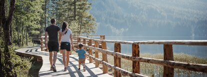
The Pustertal Valley Bike Route is particularly suitable for bicycle tours and family cycling tours, not only for beginners but also for experts. The paved bike path starts in Rio Pusteria-Mühlbach and leads via the villages of Vandoies di Sotto-Niedervintl, Vandoies di Sopra-Obervintl, Chienes-Kiens, Casteldarne-Ehrenburg and S. Lorenzo-St. Lorenzen to Brunico-Bruneck. This first section is very flat and 25.5 km long.

From Brunico, it takes about Perca-Percha, Valdaora di Sotto-Niederolang, Valdaora di Mezzo-Mitterolang, Valdaora di Sopra-Oberolang, Ried, Villabassa-Niederdorf and Dobbiaco-Toblach to San Candido-Innichen. This second section is again very flat, 33.5 km long, and suitable for everyone.

The third section takes us from San Candido on Versciaco-Vierschach to Prato Drava-Winnebach where you cross the Austro-Italian border. Now follow along the Drava River to Lienz. This last subsection is 44 km long, very easy, and ideal for families. For the return, we can use the train to come back to the starting point. If the total distance is too long, you can also take only a small part of the track, and the rest you can travel by train.

Route data
Intermediate
Distance
62,0 km
Duration
4 h 19 min
Ascent
247 m
Decent
668 m
Technical skills
Physical condition
Scenary
Highest point
1.210 m
Lowest point
725 m
How to get there

S49 Chienes-Kiens

You might be interested in
Discover related tours
Antholz Valley
Furkelpass / Passo Furcia
Distance 17,5 km
Duration 2 h 11 min
Ascent 1.373 m
Decent 584 m
Antholz Valley
Around the Kronplatz
Distance 47,5 km
Duration 4 h 24 min
Ascent 3.019 m
Decent 3.019 m
Biotope, family | © Notdurfter Anna
Intermediate
Add to favourites
To the Biotope Rasner Möser
Distance 12,4 km
Duration 1 h 08 min
Ascent 116 m
Decent 116 m
Status
open
Innichen | © TV Antholzertal, Tourismusverein Antholzertal
Intermediate
Add to favourites
Antholz Valley
To Innichen
Distance 25,2 km
Duration 1 h 52 min
Ascent 342 m
Decent 184 m
Lake Antholz | © Giro d\\\\\\\\\\\\\\\\\\\\\\\\\\\\\\\'Italia, Tourismusverein Antholzertal
Intermediate
Add to favourites
Antholz Valley
To the Lake Antholz
Distance 18,1 km
Duration 1 h 42 min
Ascent 778 m
Decent 155 m
Antholz Valley
To St. Jakob in Defereggental (AUT)
Distance 37,9 km
Duration 3 h 24 min
Ascent 1.656 m
Decent 1.383 m
Status
closed