Pfalzen / Falzes – Irenberg

Bruneck and surroundings
Add to favourites
Difficulty
Easy
Duration
2:00
in hours
Distance
4.9
in km
Suggested period
Jan
Feb
Mar
Apr
May
Jun
Jul
Aug
Sep
Oct
Nov
Dec
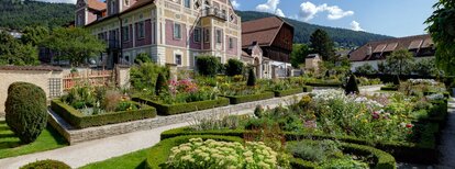
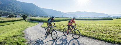
Easy walk, suitable for families, also with stroller, from the sports area in Pfalzen/Falzes to Irenberg.
Route data
Easy
Distance
4,9 km
Duration
2 h 00 min
Ascent
126 m
Decent
126 m
Technical skills
Physical condition
Scenary
Highest point
1.054 m
Lowest point
936 m
Directions
The starting point is the sports zone in Pfalzen/Falzes. Hike up the Irenberg road for a short distance and then follow trail no. 8A on the right and through the forest, until you reach the Irenberg inn. Walk northwards to the edge of the forest, then take forest path no. 6 towards the "Issinger Weiher" pond and finally, following the signpost "Pfalzen", return to the sports area.
How to get there
Public transport from Mobility Center Bruneck/Brunico:
With the bus 421 or 422 to Pfalzen/Falzes, bus stop Town Hall, and after 5-10 minutes walk to the sports area.
You might be interested in
Discover related tours
Bruneck and surroundings
Lanebach
Distance 3,6 km
Duration 2 h 05 min
Ascent 662 m
Decent 0 m
Bruneck and surroundings
Gaisinger "Waalweg"
Distance 5,3 km
Duration 2 h 00 min
Ascent 140 m
Decent 140 m
Dolomites | © Skirama Kronplatz, Bruneck Kronplatz Tourismus
Intermediate
Add to favourites
Bruneck and surroundings
Plan de Corones > Pracken > Malga Oberegger > Casola
Distance 8,3 km
Duration 3 h 30 min
Ascent 0 m
Decent 1.119 m
Status
closed
Bruneck and surroundings
Kaiserwarte
Distance 2,1 km
Duration 44 min
Ascent 166 m
Decent 0 m
Welsberg Monguelfo | © TG Gsiesertal Welsberg Taisten_Kamilla Photography, Gsieser Tal–Welsberg–Taisten
Intermediate
Add to favourites
Bruneck and surroundings
Camino de Santiago, stage Monguelfo – Valdaora – Nessano – Brunico
Distance 21,3 km
Duration 5 h 51 min
Ascent 441 m
Decent 695 m
picnic area | © Tourismusverein Kiens, Kiens
Intermediate
Add to favourites
Bruneck and surroundings
Culture and landscapes
Distance 12,1 km
Duration 3 h 27 min
Ascent 341 m
Decent 341 m