Theme walk: "A Soredl"

San Vigilio - San Martin
Add to favourites
Difficulty
Easy
Duration
1:39
in hours
Distance
5.5
in km
Suggested period
Jan
Feb
Mar
Apr
May
Jun
Jul
Aug
Sep
Oct
Nov
Dec

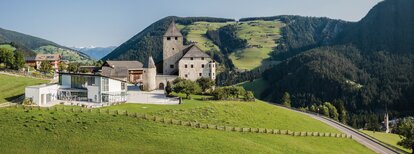
Starting from the Miara cable car, the path winds up the sunny slopes of Ras and Costa. Following
the signs to “A Sorëdl” and walking via Val you reach the hamlet Torpëi. From there continue left on the tarmac road until you reach the village at the level of the Hotel Monte Paraccia

Route data
Easy
Distance
5,5 km
Duration
1 h 39 min
Ascent
226 m
Decent
208 m
Technical skills
Physical condition
Scenary
Highest point
1.412 m
Lowest point
1.217 m
How to get there
By express highway Rosenheim-Kufstein-Innsbruck-Brenner up to exit "Brixen", where you continue toward the Pustertal (Val Pusteria). After about 20 km on the Pustertal na-tional road, always heading toward Bruneck, you turn off to your right just before St. Lorenzen, into the Gadertal, heading towards Alta Badia. The SS244 carries you up to San Vigilio.
You might be interested in
Discover related tours
San Vigilio - San Martin
Panoramic path Concordia 360°
Distance 4,8 km
Duration 1 h 31 min
Ascent 272 m
Decent 272 m
Status
closed
San Vigilio - San Martin
Barrier-free walk: San Vigilio - Pares - Seres
Distance 1,0 km
Duration 20 min
Ascent 68 m
Decent 6 m
Monte Muro | © San Vigilio, St. Vigil in Enneberg
Intermediate
Add to favourites
San Vigilio - San Martin
Winter hike to Maurerberg
Distance 7,6 km
Duration 3 h 06 min
Ascent 865 m
Decent 60 m
San Vigilio - San Martin
Theme walk: Tres la Val
Distance 13,7 km
Duration 4 h 03 min
Ascent 497 m
Decent 57 m
Status
closed
Abenteuerweg | © CT San Vigilio/San Martin, St. Vigil in Enneberg
Intermediate
Add to favourites
San Vigilio - San Martin
Adventure hike Piz de Plaies
Distance 1,5 km
Duration 45 min
Ascent 112 m
Decent 31 m
Antersasc | © Associazione Turistica San Martin de Tor, St. Vigil in Enneberg
Intermediate
Add to favourites
San Vigilio - San Martin
Summer hike: Lungiarü - Muntcörta - Antersasc
Distance 8,0 km
Duration 3 h 32 min
Ascent 1.014 m
Decent 26 m
Status
closed