Walk: San Vigilio - Spiaggetta Ciamaor

San Vigilio - San Martin
Add to favourites
Difficulty
Easy
Duration
0:30
in hours
Distance
1.8
in km
Suggested period
Jan
Feb
Mar
Apr
May
Jun
Jul
Aug
Sep
Oct
Nov
Dec

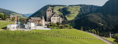
Either from the village square via Valiares or from the Aqua Bad Cortina Oasis Hotel, follow the Tres La Val trail up to the Spiaggetta Ciamaor park. Walk back taking the same route or turn right at the edge of the sports ground and follow the Tru dles Liondes trail which leads to the Nature Park House.

Route data
Easy
Distance
1,8 km
Duration
30 min
Ascent
47 m
Decent
17 m
Technical skills
Physical condition
Scenary
Highest point
1.233 m
Lowest point
1.198 m
How to get there
By express highway Rosenheim-Kufstein-Innsbruck-Brenner up to exit "Brixen", where you continue toward the Pustertal (Val Pusteria). After about 20 km on the Pustertal na-tional road, always heading toward Bruneck, you turn off to your right just before St. Lorenzen, into the Gadertal, heading towards Alta Badia. The SS244 carries you up to San Vigilio.
You might be interested in
Discover related tours
San Vigilio - San Martin
Walk: San Vigilio - Torpei - Pinei
Distance 3,1 km
Duration 55 min
Ascent 128 m
Decent 170 m
Status
closed
San Vigilio - San Martin
Walk: San Vigilio - Ciasè
Distance 2,4 km
Duration 39 min
Ascent 61 m
Decent 61 m
San Vigilio - San Martin
Walk: San Vigilio - Tamersc - Pederü
Distance 12,2 km
Duration 3 h 31 min
Ascent 364 m
Decent 27 m
Status
closed
San Vigilio - San Martin
Walk: San Vigilio - Passo Furcia
Distance 5,3 km
Duration 1 h 59 min
Ascent 533 m
Decent 11 m
Antersasc | © Associazione Turistica San Martin de Tor, St. Vigil in Enneberg
Intermediate
Add to favourites
San Vigilio - San Martin
Summer hike: Lungiarü - Muntcörta - Antersasc
Distance 8,0 km
Duration 3 h 32 min
Ascent 1.014 m
Decent 26 m
Status
closed
View from Ju | © Ass. Turistica San Martin, St. Vigil in Enneberg
Intermediate
Add to favourites
San Vigilio - San Martin
Hike from San Martin across Piculin and Gran Jú to Col dl'Ancona
Distance 4,7 km
Duration 1 h 54 min
Ascent 530 m
Decent 47 m