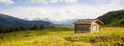
The Kaser Alm hut in the Val Casies Valley (2076m)

Val Casies Valley - Monguelfo - Tesido
Add to favourites
Difficulty
Intermediate
Duration
3:30
in hours
Distance
10
in km
Suggested period
Jan
Feb
Mar
Apr
May
Jun
Jul
Aug
Sep
Oct
Nov
Dec

Across beautiful mountain meadows

Starting point: Val Casies Valley / S. Maddalena head of the valley (1460m)
Distance: 10 km
Descent: percorso circolare
Walking time: 03:30 h
Difficulty: medium
Difference in altitude: 616 m Information: www.suedtirolmobil.info - Lin. 441

Route data
Intermediate
Distance
10,0 km
Duration
3 h 30 min
Ascent
673 m
Decent
674 m
Technical skills
Physical condition
Scenary
Highest point
2.087 m
Lowest point
1.460 m
Directions

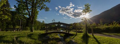
From the head of the valley at S. Maddalena/Val Casies Valley (1460m, refreshment facilities, parking fee) follow trail marker No. 47/48 across the bridge over the Pidig Bach stream. Turn left and after the Schlosser Hof farm turn right. The trail leads along an old sheep trail to the Tscharniet valley. Follow forest road No. 47 to the Köfler Alm alpine pasture (1808m, no refreshments available). You cross over a narrow bridge over the stream and then reach, after approx. 20 minutes, the Stumpfalm hut (2000m, refreshment possibility). Then cross to the left on the small road over beautiful meadows and pastureland in a northerly direction for 20 minutes to the Kaser Alm hut (2076m, refreshment possibility). Finally switch to the Pfoital valley, descending it on trail No. 13 through woods to the starting point.

public transportation
Bus & train timetable: www.suedtirolmobil.info.
How to get there
Coming from Innsbruck/Brennero (A): Drive on the Highway of Brennero (A22) until the exit Bressanone/Val Pusteria, then go on along the SS49-E66 for about 58kms until you arrive in Monguelfo. To get to Tesido and the Val Casies Valley, we recommend to take the exit West in Monguelfo.
Coming from Lienz (A): You can reach us also padding by Lienz in Westtyrol (A). You have to cross the Austrian-Italian border between Ahrnbach and Winnebach (B100-E66) and drive on the SS46-E66 until Monguelfo. To get to Tesido and the Val Casies, we recommend to take the exit West in Monguelfo.
Where to park
Parking lots on payment at the head of the valley in S. Maddalena.
You might be interested in
Discover related tours
Val Casies Valley - Monguelfo - Tesido
On Paul Troger's Traces
Distance 5,4 km
Duration 1 h 41 min
Ascent 268 m
Decent 268 m
Brunst hut | © Kottersteger, Olang
Intermediate
Add to favourites
Val Casies Valley - Monguelfo - Tesido
Hiking Tour Valdaora/Olang
Distance 15,1 km
Duration 5 h 18 min
Ascent 1.207 m
Decent 1.213 m
Lutterkopf | © TV Antholzertal - Barbara, Tourismusverein Antholzertal
Intermediate
Add to favourites
Val Casies Valley - Monguelfo - Tesido
Lutterkopf - Durakopf
Distance 17,4 km
Duration 6 h 00 min
Ascent 1.176 m
Decent 1.176 m
Status
closed
Val Casies Valley - Monguelfo - Tesido
The Ascht Alm hut in Val Casies Valley (1950m)
Distance 4,4 km
Duration 1 h 48 min
Ascent 499 m
Decent 0 m
Uwaldalm | © Uwaldalm, Gsieser Tal–Welsberg–Taisten
Intermediate
Add to favourites
Val Casies Valley - Monguelfo - Tesido
The Uwald Alm hut in the Val Casies Valley (2043m)
Distance 4,7 km
Duration 2 h 02 min
Ascent 582 m
Decent 2 m
Val Casies Valley - Monguelfo - Tesido
Family hike Valdaora di Sopra – Monguelfo/Oberolang – Welsberg
Distance 7,7 km
Duration 2 h 54 min
Ascent 175 m
Decent 137 m
Status
closed