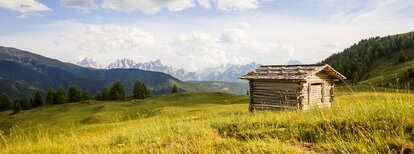
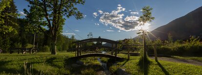
The Tolder Hütte hut in the Val Casies Valley (1942m)

Val Casies Valley - Monguelfo - Tesido
Add to favourites
Difficulty
Intermediate
Duration
2:13
in hours
Distance
4.6
in km
Suggested period
Jan
Feb
Mar
Apr
May
Jun
Jul
Aug
Sep
Oct
Nov
Dec

On the shepherds’ track

Starting point: Val Casies Valley / S. Martino tourist information office (1276m)
Distance: 4,6 km
Descent: along the same route
Walking time: 02:00 h
Difficulty: medium
Difference in altitude: 666 m
Information: www.suedtirolmobil.info - Lin. 441

Route data
Intermediate
Distance
4,6 km
Duration
2 h 13 min
Ascent
657 m
Decent
0 m
Technical skills
Physical condition
Scenary
Highest point
1.937 m
Lowest point
1.275 m
Directions

From the tourist office in S. Martino/Val Casies Valley (1276m), continue east along a very wide and steep forest road (marker No. 44), which leads through the forest in several hairpin bends to the "Außerhütten" huts. The first huts of the Versell Alm alpine pasture (1670m, no refreshment facilities) are the starting point for a hike on a less steep forest road through the forest to the Randlhütte hut (1862m, refreshment stop). The next refreshment stop is to find only about 500 m uphill, the Tolder Hütte hut (1942m).

public transportation
Bus & train timetable: www.suedtirolmobil.info.
How to get there
Coming from Innsbruck/Brennero (A): Drive on the Highway of Brennero (A22) until the exit Bressanone/Val Pusteria, then go on along the SS49-E66 for about 58kms until you arrive in Monguelfo. To get to Tesido and the Val Casies Valley, we recommend to take the exit West in Monguelfo.
Coming from Lienz (A): You can reach us also padding by Lienz in Westtyrol (A). You have to cross the Austrian-Italian border between Ahrnbach and Winnebach (B100-E66) and drive on the SS46-E66 until Monguelfo. To get to Tesido and the Val Casies, we recommend to take the exit West in Monguelfo.
Where to park
Various parking possibilities in the village centre of S. Martino.
You might be interested in
Discover related tours
"Gsieser Almweg 2000" | © TV Gsieser Tal_Harald Wisthaler, Gsieser Tal–Welsberg–Taisten
Intermediate
Add to favourites
Val Casies Valley - Monguelfo - Tesido
The “Almweg 2000” trail in the Val Casies Valley
Distance 48,4 km
Duration 15 h 18 min
Ascent 2.590 m
Decent 2.793 m
Val Casies Valley - Monguelfo - Tesido
The Ascht Alm hut in Val Casies Valley (1950m)
Distance 4,4 km
Duration 1 h 48 min
Ascent 499 m
Decent 0 m
Dolomites view | © Tourismusverein  Antholzertal, Tourismusverein Antholzertal
Intermediate
Add to favourites
Val Casies Valley - Monguelfo - Tesido
Dolomites panoramic view tour
Distance 9,1 km
Duration 2 h 58 min
Ascent 555 m
Decent 555 m
Welsberg Monguelfo | © ©TV Gsieser Tal_Georg Hofer (17), Gsieser Tal–Welsberg–Taisten
Intermediate
Add to favourites
Val Casies Valley - Monguelfo - Tesido
Camino de Santiago, stage San Candido - Dobbiaco - Villabassa - Monguelfo
Distance 18,0 km
Duration 4 h 46 min
Ascent 219 m
Decent 302 m
"Gsieser Almweg 2000" | © TV Gsieser Tal_Harald Wisthaler, Gsieser Tal–Welsberg–Taisten
Intermediate
Add to favourites
Val Casies Valley - Monguelfo - Tesido
The “Almweg 2000” trail in the Val Casies Valley | trait across the alpine pastures Tscharnietalm-Kaser Alm-Stumpfalm-Uwald Alm
Distance 16,7 km
Duration 5 h 24 min
Ascent 983 m
Decent 983 m
Val Casies Valley - Monguelfo - Tesido
Winter walking tour to the mountain hut Messner Hütte in S. Maddalena
Distance 3,0 km
Duration 50 min
Ascent 200 m
Decent 0 m
Status
closed