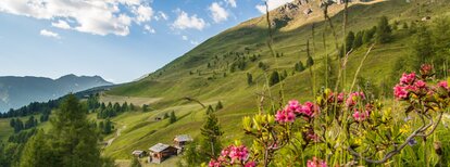
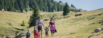
The Uwald Alm hut in the Val Casies Valley (2043m)

Val Casies Valley - Monguelfo - Tesido
Add to favourites
Difficulty
Intermediate
Duration
2:02
in hours
Distance
4.7
in km
Suggested period
Jan
Feb
Mar
Apr
May
Jun
Jul
Aug
Sep
Oct
Nov
Dec

With its great view over the Val Casies Valley

Starting point: Val Casies Valley / S. Maddalena head of the valley (1460m)
Distance: 5 km
Descent: along the ascending route
Walking time: 02:00 h
Difficulty: media
Difference in altitude: 583 m
Information: www.suedtirolmobil.info - Lin. 441

Route data
Intermediate
Distance
4,7 km
Duration
2 h 02 min
Ascent
582 m
Decent
2 m
Technical skills
Physical condition
Scenary
Highest point
2.042 m
Lowest point
1.460 m
Directions

From the head of the valley at S. Maddalena/Val Casies Valley (1460m, refreshment facilities, parking fee) follow trail marker No. 12 across the bridge in a left-hand direction. After passing the Schlosser Hof farm, take the old path to the right. In the vicinity of the Burgerhof farm you cross the bridge over the Pfoibach stream and continue along the forest road through the forest. As you continue, you encounter small clearings that offer beautiful views of the Val Casies Valley and the Braies Dolomites. You cross the mountain stream a second time, walk through alpine meadows and soon reach a crossroad, walking to your left that leads through meadows and woods to the Uwald Alm hut (2043m, refreshment possibility).

public transportation
Bus & train timetable: www.suedtirolmobil.info.
How to get there

Coming from Innsbruck/Brennero (A): Drive on the Highway of Brennero (A22) until the exit Bressanone/Val Pusteria, then go on along the SS49-E66 for about 58kms until you arrive in Monguelfo. To get to Tesido and the Val Casies Valley, we recommend to take the exit West in Monguelfo.
Coming from Lienz (A): You can reach us also padding by Lienz in Westtyrol (A). You have to cross the Austrian-Italian border between Ahrnbach and Winnebach (B100-E66) and drive on the SS46-E66 until Monguelfo. To get to Tesido and the Val Casies, we recommend to take the exit West in Monguelfo.

Where to park
Parking lot on payment at the head of the valley in S. Maddalena.
You might be interested in
Discover related tours
Val Casies Valley - Monguelfo - Tesido
The Messnerhütte hut in the Val Casies Valley (1660m)
Distance 3,1 km
Duration 1 h 00 min
Ascent 199 m
Decent 0 m
"Gsieser Almweg 2000" | © TV Gsieser Tal_Harald Wisthaler, Gsieser Tal–Welsberg–Taisten
Intermediate
Add to favourites
Val Casies Valley - Monguelfo - Tesido
The “Almweg 2000” trail in the Val Casies Valley
Distance 48,4 km
Duration 15 h 18 min
Ascent 2.590 m
Decent 2.793 m
Welsberg Monguelfo | © TG Gsiesertal Welsberg Taisten_Kamilla Photography, Gsieser Tal–Welsberg–Taisten
Intermediate
Add to favourites
Val Casies Valley - Monguelfo - Tesido
Camino de Santiago, stage Monguelfo – Valdaora – Nessano – Brunico
Distance 21,3 km
Duration 5 h 51 min
Ascent 441 m
Decent 695 m
Val Casies Valley - Monguelfo - Tesido
The Taistner Vorderalm hut at Tesido (2012m)
Distance 4,1 km
Duration 1 h 29 min
Ascent 381 m
Decent 0 m
Val Casies Valley - Monguelfo - Tesido
Strolling from farm to farm in the Val Casies Valley
Distance 9,6 km
Duration 2 h 37 min
Ascent 171 m
Decent 171 m
"Gsieser Almweg 2000" | © TV Gsieser Tal_Harald Wisthaler, Gsieser Tal–Welsberg–Taisten
Intermediate
Add to favourites
Val Casies Valley - Monguelfo - Tesido
The “Almweg 2000” trail in the Val Casies Valley | trait across the alpine pastures Tscharnietalm-Kaser Alm-Stumpfalm-Uwald Alm
Distance 16,7 km
Duration 5 h 24 min
Ascent 983 m
Decent 983 m