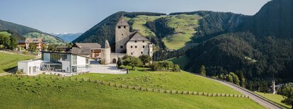
Summer hike: Lungiarü - Muntcörta - Antersasc - Puez Inn

San Vigilio - San Martin
Add to favourites
Difficulty
Intermediate
Duration
3:27
in hours
Distance
6.8
in km
Status
closed
Suggested period
Jan
Feb
Mar
Apr
May
Jun
Jul
Aug
Sep
Oct
Nov
Dec

Follow forest road No. 9 through the forest until you reach the Antersasc alpine pasture. From here, climb northwards to Crëp dales Dodesc. For the Puez hut, walk to the end of the meadow, where an uphill path leads past the gorge. After a short descent, you will reach the Rifugio Puez inn which offers food, drinks and accommodation.

Route data
Intermediate
Distance
6,8 km
Duration
3 h 27 min
Ascent
1.042 m
Decent
64 m
Technical skills
Physical condition
Scenary
Highest point
2.519 m
Lowest point
1.501 m
How to get there
Take Bressanone North - Val Pusteria highway exit, continue via San Lorenzo, into Val Badia to San Martin de Tor. Pass the village and continue to Lungiarü.
You might be interested in
Discover related tours
Pice Ju | © Obwegs Carlo, St. Vigil in Enneberg
Intermediate
Add to favourites
San Vigilio - San Martin
Hike around Pice Ju
Distance 2,7 km
Duration 1 h 15 min
Ascent 140 m
Decent 140 m
San Vigilio - San Martin
Winter walk: San Vigilio - Lé dla Creda
Distance 3,3 km
Duration 56 min
Ascent 96 m
Decent 27 m
Open Air Museum | © Associazione Turistica San Martin de Tor, St. Vigil in Enneberg
Intermediate
Add to favourites
San Vigilio - San Martin
Summer hike: Vì - Open Air Museum - Göma
Distance 2,8 km
Duration 1 h 31 min
Ascent 473 m
Decent 0 m
Status
closed
San Vigilio - San Martin
Barrier-free walk: San Vigilio - Spiaggetta Ciamaor
Distance 1,3 km
Duration 30 min
Ascent 15 m
Decent 3 m
Abenteuerweg | © CT San Vigilio/San Martin, St. Vigil in Enneberg
Intermediate
Add to favourites
San Vigilio - San Martin
Adventure hike Piz de Plaies
Distance 1,5 km
Duration 45 min
Ascent 112 m
Decent 31 m
Ciastlins | © Obwegs Carlo, St. Vigil in Enneberg
Intermediate
Add to favourites
San Vigilio - San Martin
Hike to Senes pastures across Ciastilins
Distance 10,8 km
Duration 4 h 42 min
Ascent 1.338 m
Decent 466 m
Status
closed